- Test Form
- Bylaws + enforcement
- Waste management
- Roads, sidewalks + construction
- Water + environment
- Building + renovating
- Community services
- City News
- Community outdoor rinks
- Medical facility and Doctor recruitment
- Warming and cooling centres
- Quinte West Fire and Emergency Services
- Community grants
- Marriages + oaths
- Public transit
- Licensing
- Animals + pets
- Parking
- Quinte West OPP
- Quinte West Remembers
- In Their Shoes awareness event
- Community Safety and Well-being
- Parks, trails + facilities
- News + notices
- Tourism + events
- Quinte West Discovery Guide
- Trent Port Marina
- Front Street Farmers' Market
- Quinte West Summer Pop-ups
- Hops on the Water Craft Beer Festival
- 2024 Canada Soccer Toyota National Championships
U-15 Cup - City-run events + activities
- Community event calendar
- Host an event
- Winter Activities
- Visit + explore
- Canada Day
- Tourism plan + strategies
- FALL in love with Quinte West
- Feedback + engagement
- Employment + volunteering
- Planning + development
- Economic Development
- Contact
- City Budget
- Property taxes + finance
- Council + city administration
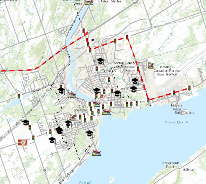
Quinte West Maps
GIS is operated and maintained by the City’s GIS Division, which offers a multi-platform GIS for IOS (Apple), Android, and Windows. The application will be compatible with most desktop and mobile devices.

GIS is operated and maintained by the City’s GIS Division, which offers a multi-platform GIS for IOS (Apple), Android, and Windows. The application will be compatible with most desktop and mobile devices.
Features of the City’s Public GIS Site include:
- Instant Information search for various layers such as properties, 911 addresses, and zoning
- Live weather radar
- Aerial photography
- Print to pdf
- Create a grid overlay
- Change underlying base maps, including satellite imagery
- Track your GPS location
- Application sharing
Data displayed, including property lines, are for illustrative purposes only and do not substitute a Legal Survey.
*Disclaimer: GIS Maps is for personal use and non-commercial use. All data and related graphics in the GIS are protected by copyright. Data displayed is for illustrative purposes only and does not substitute a Legal Survey. The City of Quinte West and its employees will not be held liable for any claims resulting from damages or losses resulting from the use of this application. Do not rely on this map for legal administrative purposes or applications that require accurate positional data. Do not rely on it as being a precise indicator of routes, locations of features, or as a guide to navigation. This map may contain cartographic errors or omissions.
Please contact GIS Services at GIS@quintewest.ca for more information on this municipal service or GIS-related services.
The Topographic GIS Map Application features 1-metre contour elevations and other valuable layers of information such as property boundaries, wooded areas, watercourses, walking trails, parkland, aerial photographs, and satellite imagery. Click here to view the interactive topographic GIS map. To review elevations as a topographic map comparison or elevation profile.
National Topographic Series (NTS) Sheets
Topographic Maps (NTS Sheets) 1:50,000 31C/3 (PDF), 31C/4 (PDF), 31C/5 (PDF), 31C/6 (PDF).
Topographic GIS Data
Topographic GIS data for the City of Quinte West can be downloaded and used. These are available at the Open GIS Data Portal.
The City of Quinte West Economic Development (QWED) GIS mapping application will help you find available lands and buildings.
This platform is used for exploring and downloading open Geographic Information Systems (GIS) data. GIS is the input, storage, manipulation, analysis, reporting, and output of digital spatial data using computers and peripherals. Click here to learn more.
These are links to favourite map locations using the Public GIS Mapping Application:
- Public GIS Map
- City of Quinte West City Hall & Library
- City of Quinte West Frankford Municipal Office & Library
- City of Quinte West Trent Port Marina
- City of Quinte West Trenton Memorial Gardens
- City of Quinte West Frankford Arena
- Afghanistan Repatriation Memorial and Bain Park
- Quinte West Fire Station 1
- Quinte West OPP Station
- Trenton Memorial Hospital
- City of Quinte West YMCA
- Restaurants Offering Take Out During Covid-19
- Marina Slip Availability
- Quinte West Arts & Culture
- Recreational Activities in Quinte West
- Quinte West Bag Tag Sellers
- Pharmacies in Quinte West
- City of Quinte West Hydrant Flushing Schedule
- Schools Near Me in Quinte West
- Golf Courses Near Me in Quinte West
- 2018 Quinte West Polling Station
- City of Quinte West Imagery
- City of Quinte West Facilities
- City of Quinte West Fire Hall GIS Map
- Live Radar & Temperatures
- City of Quinte West Downtown Trenton Parking Lots
- Quinte West Trails
- Directions to Trenton Memorial Hospital
- Centennial Park Facilities
- City of Quinte West 2018 Development Projects
- City of Quinte West Sidewalks
- City of Quinte West Road Closures
- Quinte West Regular Garbage & Recycling Schedule
- Base Mapping for Mobile
- To Quinte West City Hall, Library, and Trent Port Marina
- Quinte West Social Media Map
- City of Quinte West 3D Scene
- Zoning bylaw schedules
- Official Plan schedules
Parks
| Service Type | Fee |
| Professional GIS Design Services (Per Hour) | $ 200 |
| Planning Maps – Large | $70 |
| Planning Maps – Medium | $35 |
| Planning Maps – Small | $25 |
| Aerial Photos – Letter Size | $55 |
| Aerial Photos – Large (3 ft by 4 ft approx.) | $200 |
| Aerial Photos – 11 x 17 sheet | $70 |
| IT/GIS Technical Support (Per Hour) | $200 |
| Cancellation Penalty | $200 |
| GIS / IT Consulting (not related to Maintenance Agreement) (Per Hour) | $200 |
| MPT Calculator | $5,000 |
| MPT Calculator – Annual Renewal | $750 |
What Are You Looking For?
You can use the smart search field below to find anything on the site from pages, events, documents and more. Simply start typing and the search will suggest possible results for you.